
HydroClimExHydroclimate Extremes LabWestern University

Projects

Projects

Current funded projects and signature past work, with the partners, years and papers behind each one.

Current

Current projects

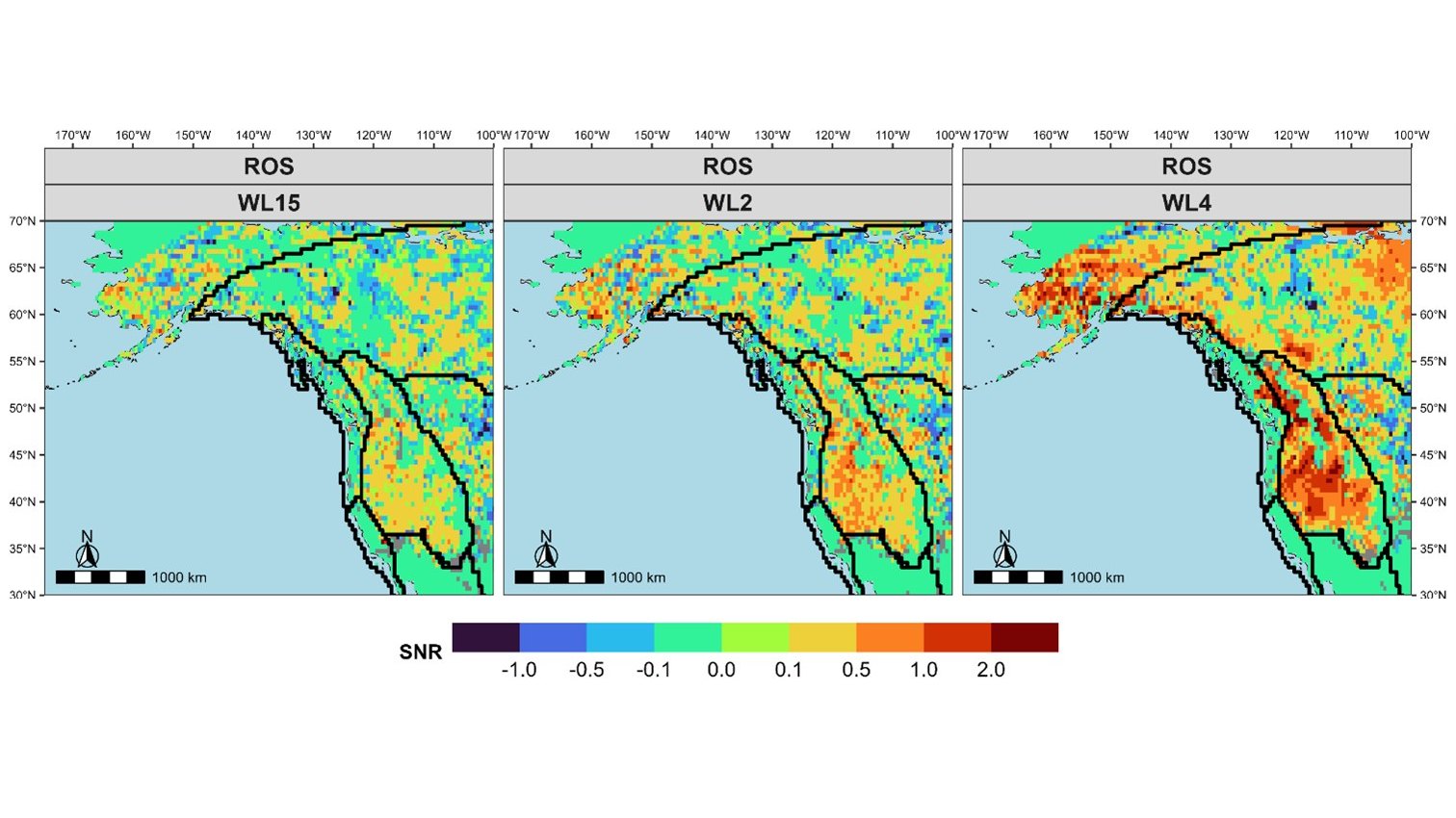
Maps of the signal to noise ratio of change in rain on snow compound floods across western North America at 1.5, 2 and 4 degrees of warmingAcross Canada

Nonstationary compound hydroclimatic extremes

The lab's core NSERC Discovery program: how compound and successive extremes change in a warming climate, and what that means for the design values and resilience of infrastructure.
Years
2024 to 2029
Role
Principal investigator
Funder
NSERC Discovery Grant
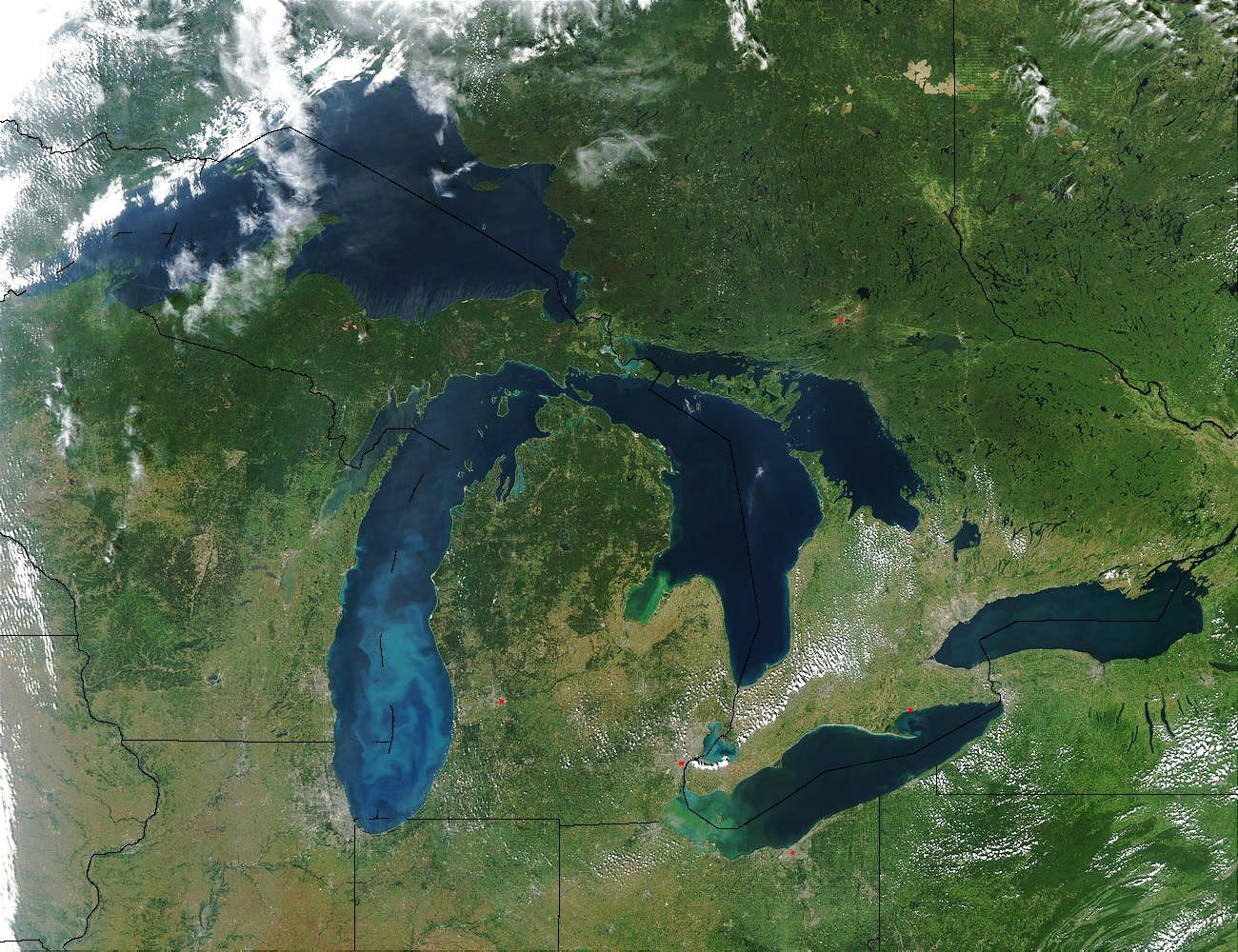
Satellite view of the Great LakesGreat Lakes basin

Concurrent and sequential flood hazards in the Great Lakes

An integrated framework for multiple flood hazards that strike together or in sequence across the Great Lakes basin under climate change, from WRF-Hydro simulations to flood frequency.
Years
2024 to 2029
Role
Principal investigator
Funder
Ontario Early Researcher Award
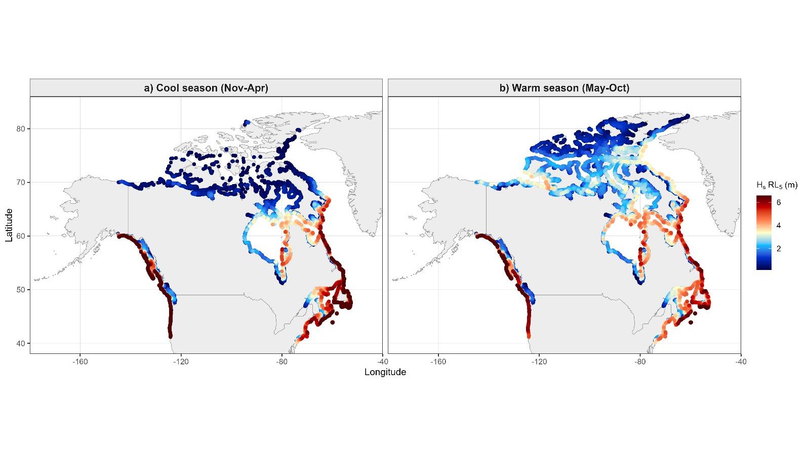
Maps of the 5-year return level of significant wave height along Canada's Pacific, Arctic and Atlantic coasts in the cool and warm seasonsPacific, Atlantic and Arctic coasts

Compound flood processes and climate risk in Canada

A national framework for coastal and inland compound floods with Environment and Climate Change Canada: atmospheric, hydrological and coastal drivers, NEMO-based coastal hindcasts, storm attribution and machine learning emulators.
Years
2024 to 2027
Role
Principal investigator
Partner
Environment and Climate Change Canada
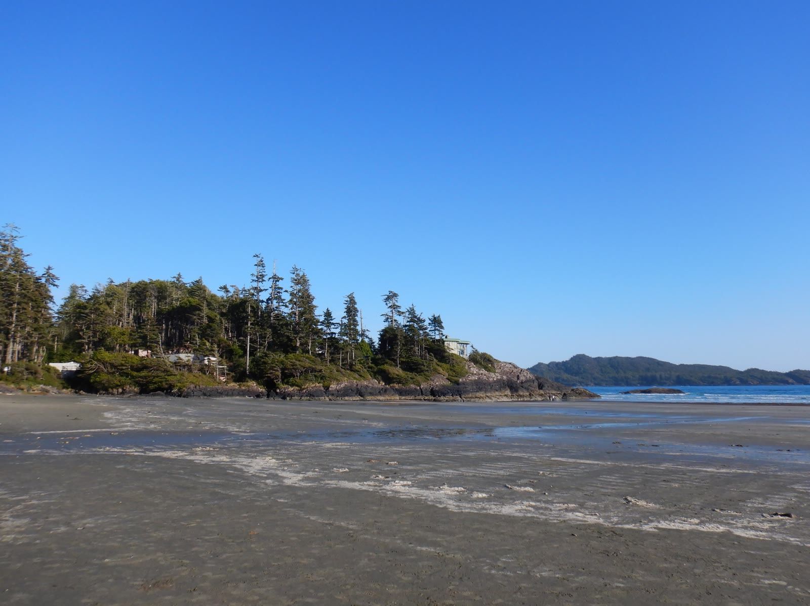
Tofino shoreline at low tideTofino, Cuba and Indonesia

CIRCLE: community and infrastructure resilience

A New Frontiers in Research Fund project in which coastal communities co-design resilience to long-term climate and geological hazards through living labs in Canada, Cuba and Indonesia. We lead the climate change and coastal flooding component, with workshops in Tofino and Cuba and visiting researchers from CUJAE in Havana.
Years
2024 to 2027
Role
Co-principal investigator; climate and coastal flood lead
Lead
K. Goda, Western, with Dalhousie, CUJAE and partners in Indonesia and the UK
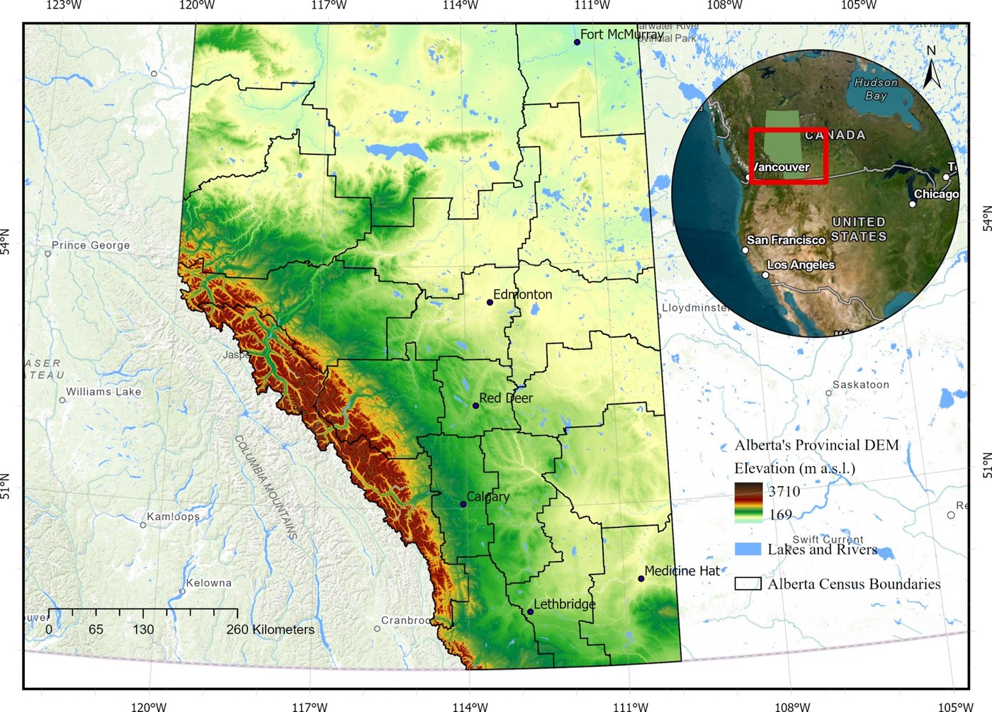
Elevation map of Alberta, the core of Canada's hail alley, with Calgary, Red Deer and EdmontonAlberta

Northern Hail Project

A national NSERC and Mitacs Alliance project on the meteorology, climatology and impacts of hail. We lead the hail and wind-driven hail hazard assessment using field, radar and satellite data.
Years
2022 to 2026
Role
Co-investigator
Lead
G. Kopp, Western
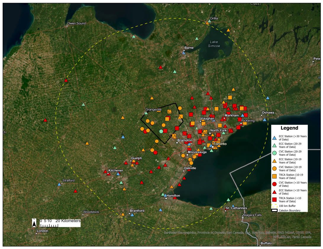
Map of rain gauges and radar coverage around CaledonCaledon, Ontario

Climate-adjusted IDF curves for the Town of Caledon

Radar and gauge records combined to update intensity-duration-frequency curves for drainage design, with projections under future warming.
Years
2025 to present
Partner
Town of Caledon, with Mitacs
People
Issam Mohamed
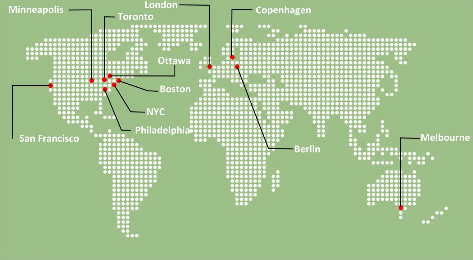
World map of the eleven cities whose stormwater practice was compared with Toronto'sToronto and ten peer cities

Equity-aware stormwater planning

An NSERC Alliance and Mitacs project with Toronto Water and the Institute for Catastrophic Loss Reduction, reviewing climate-resilient stormwater practice and weighing benefits for marginalized communities.
Years
2023 to 2026
Role
Principal investigator
Paper
Urban Climate 2025
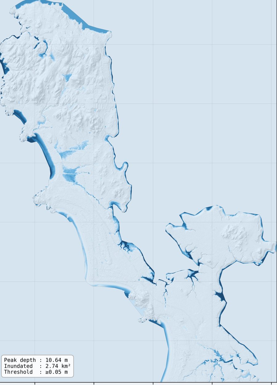
Simulated maximum water depth around Tofino
Preliminary research model output, not a regulatory hazard map. Simulated maximum water depth, 23 to 25 November 2021, LISFLOOD-FP 8.1, colour scale capped at 3 m. PhD research, M. Jafarzadeh

Case study

Mapping a compound storm in Tofino

Tofino sits on a narrow peninsula on Vancouver Island, exposed to Pacific storms on one side and inlet flooding on the other. We rebuilt three days of a late November 2021 storm in a two-dimensional flood model to see where water went, when it arrived and how long it stayed.

Preliminary simulations show flooding concentrated along low-lying shorelines and inlet margins. Model evaluation against observed water levels, sea-level rise scenarios and a machine learning emulator trained on these runs are ongoing.
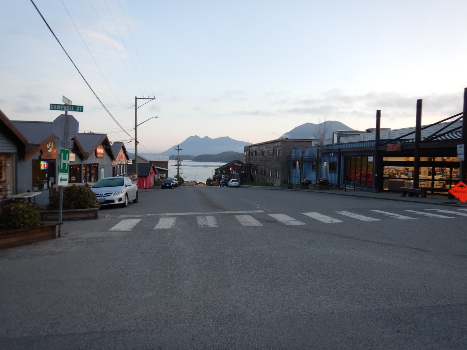
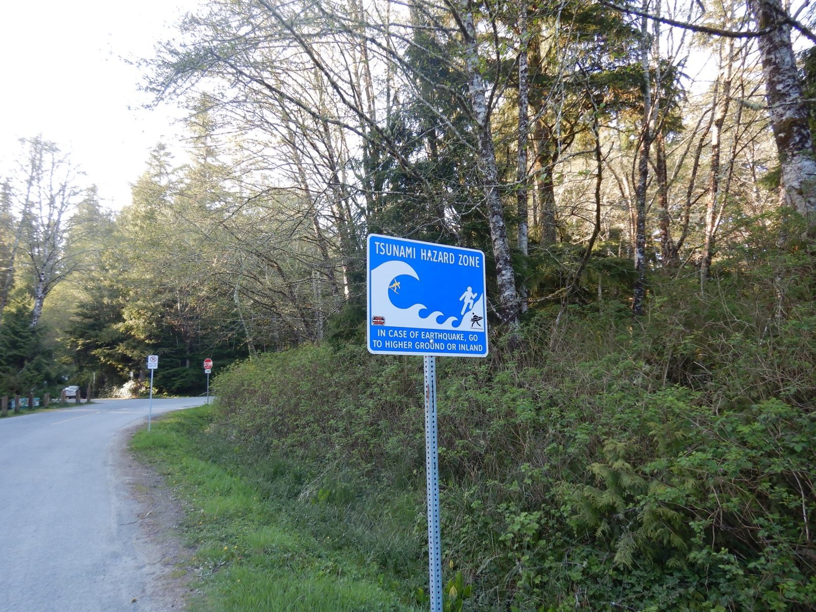
Tofino main street near the harbourTsunami hazard zone sign on a Tofino road

Field photos from the CIRCLE workshop in Tofino

Past
Signature past projects

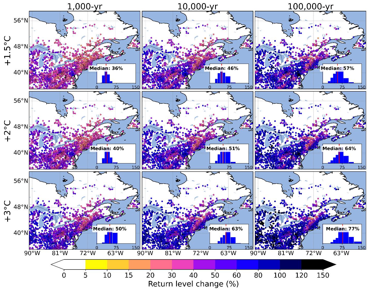
Maps of projected change in 1,000, 10,000 and 100,000-year flood levels across eastern Canada at 1.5, 2 and 3 degrees of warmingAcross Canada

Climate resilience of dams and levees

Completed in 2025: projected climate data and future design floods for dams and levees with the National Research Council. The resulting Canada Climate Viewer web tool for dam owners is now live.
Years
2021 to 2025, completed
Partner
National Research Council Canada
Papers
Discover Applied Sciences 2024; Journal of Hydrology 2025
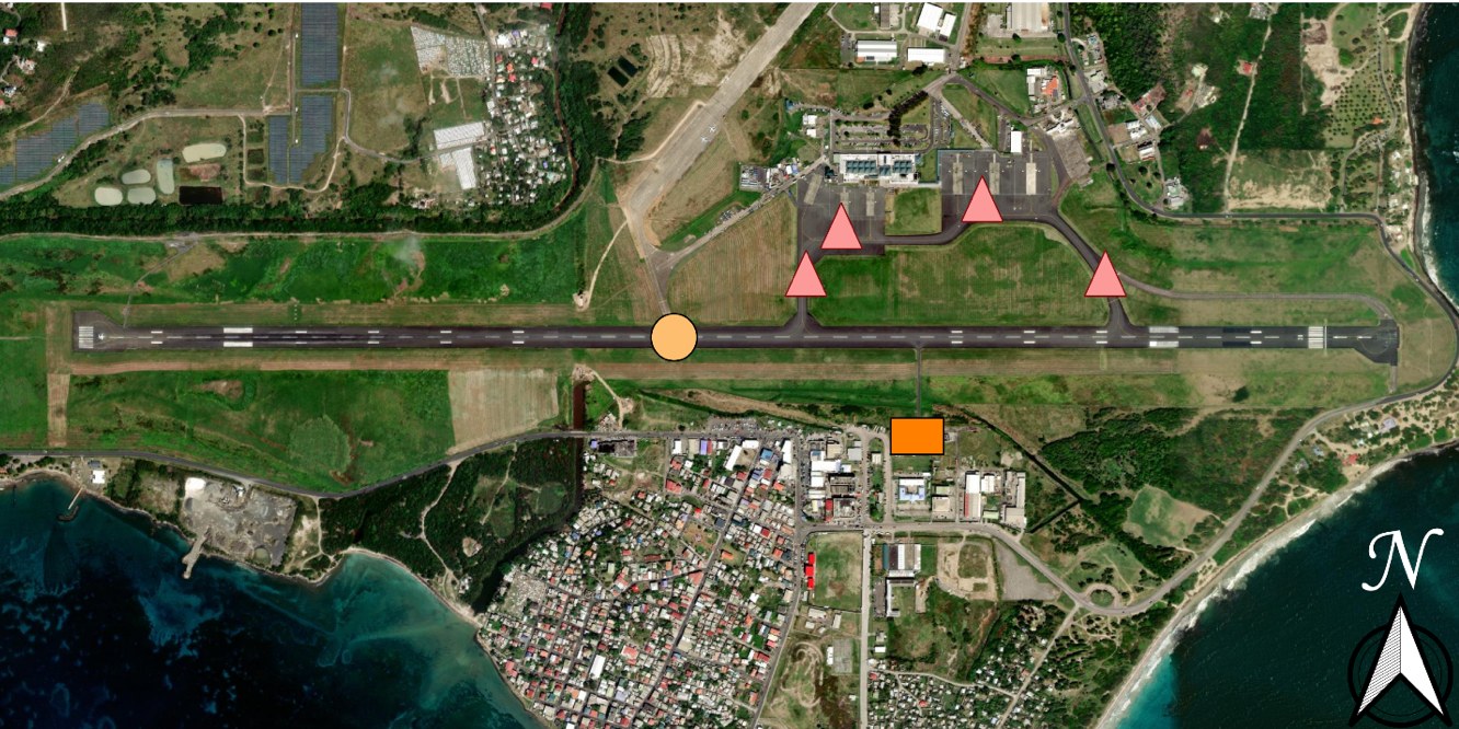
Satellite view of Hewanorra International Airport, Saint Lucia, marking the flooded runway, taxiways, apron and fire and rescue buildingSaint Lucia, Caribbean

Compound flooding and cascading infrastructure failure

Saint Lucia has short rain records and steep catchments that drain straight to the sea. We built a probabilistic flood model combining rainfall, river flow and waves for Tropical Storm Matthew (2016), then traced how flooding at the international airport spreads through operations, roads and tourism, and how fast each recovers.

Years
2018 to 2025
People
Ying (Katrina) Zhang, Soheil Bakhtiari; with K. Goda and H. Peerhossaini
Papers
Water Resources Research 2020; Sustainable Cities and Society 2021 and 2024; Reliability Engineering and System Safety 2025
Partners
Deep Logic Solutions; RiskLogik
Read the full case study
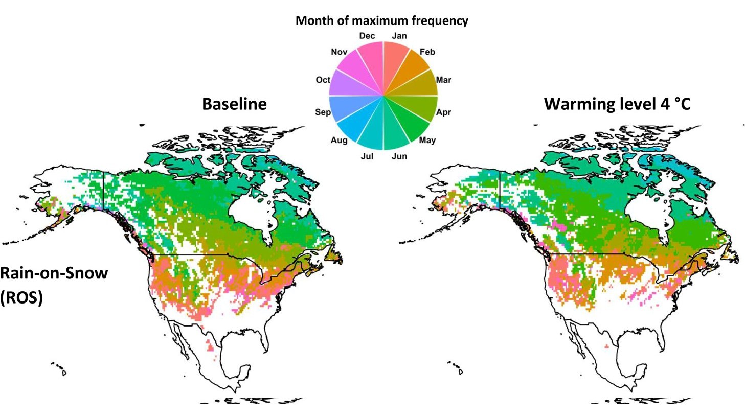
Maps of the month when rain on snow floods are most frequent across North America, now and at 4 degrees of warmingLake Winnipeg and Great Lakes

What drives the biggest river floods

For Environment and Climate Change Canada we analysed the climate variables behind extreme maximum flows in the Lake Winnipeg watershed. The question now runs basin-wide in the Great Lakes, classifying simulated floods by mechanism: rain, snowmelt, rain on snow or wet soils.

Years
2020 to 2021; Great Lakes work ongoing
Paper
Earth's Future 2025
Partner
ECCC

Disaster rapid response research

Co-principal investigator on the SSHRC Insight project Can-3R, enhancing Canadian disaster rapid response research, 2023 to 2026.

Tornadoes and flash floods together

A probabilistic assessment of tornadoes and flash floods striking together in Canada, with David Sills of the Northern Tornadoes Project (International Journal of Climatology, 2023).

York Region flood risk model

Climate analysis for a regional infrastructure flood risk model led by Lea Consulting, which received a 2025 Ontario Engineering Project Award.

Earlier funded work

  • Integrated risk assessment framework for compound flooding in Canadian urban environments, NSERC Alliance, 2020 to 2023
  • Top-down and bottom-up assessment of river flood risk under climate and land-use change, NSERC Collaborative Research and Development, 2018 to 2021
  • Compound flooding in Canadian coastal areas, historical and future, Environment and Climate Change Canada, 2023 to 2024
  • Statistical downscaling of hydroclimatic variables for the Great Lakes, Environment and Climate Change Canada, 2023
  • Stormwater modelling and climate change best practices, City of Toronto CivicLabTO, 2022 to 2023
  • Impact of cloud seeding on hail damage in Alberta, Institute for Catastrophic Loss Reduction, 2020 to 2023
  • Bias correction and merging of radar and satellite precipitation over southern Canada, NSERC Engage, 2019
  • Nonstationary modelling framework for hydroclimatic extremes, NSERC Discovery, 2017 to 2022
  • Sustainable water resources management for remote communities, Western Interdisciplinary Development Initiatives, 2023 to 2025
  • Scholars Network for Building Disaster Resilient Communities, Queen Elizabeth II Diamond Jubilee Scholarships, 2020 to 2024

Practice

Contributions to guidance and practice

Canada's Changing Climate Report 2026

Co-lead author of Chapter 5, Changes in the water cycle

CSA W224 coastal flood guide

Lead author role on the implementation guide for the Canadian standard on coastal flood risk assessment

ASCE compound flooding manual

Committee contribution to a manual of practice on compound flood methods for engineers